TheIsland@GreatBrakRiver
  • Island Amenities & Activities
    • For the Adrenaline Junky
    • Golf in the Garden Route
    • Farm Stalls & Craft Markets
    • For the Gourmand - Restaurants & Dining
    • Park & Playground
    • Swimming, Splashing & Snorkeling
    • Tennis
    • Canoeing & Kayaking
    • Yoga
    • Beach Walking
    • Hiking & Walking >
      • Great Brak River Village - The Art Route
      • Great Brak River Village - Short Walks
      • Great Brak River Village - The Historic Route
    • Running & Cycling >
      • Great Brak River Village - Cycling Routes
      • Great Brak River Village - The Fragrance Route
    • Fishing
    • Whale and Dolphin Watching
    • Birdwatching
  • Welcome to The Island@GreatBrakRiver
  • Island Blog
  • Island Etiquette & Safety
  • Getting Here
  • Photo Gallery
  • Tide Tables
  • About Me

A Quick Zip up to The Old Great Brak Power Station

4/2/2016

0 Comments

 
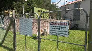
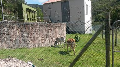
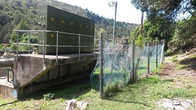
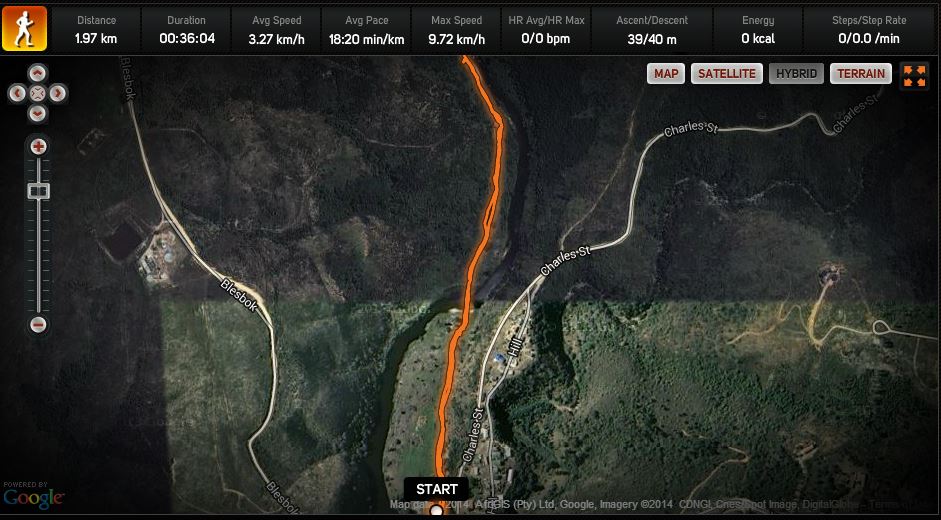
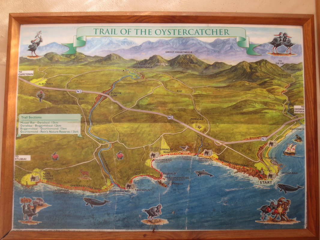
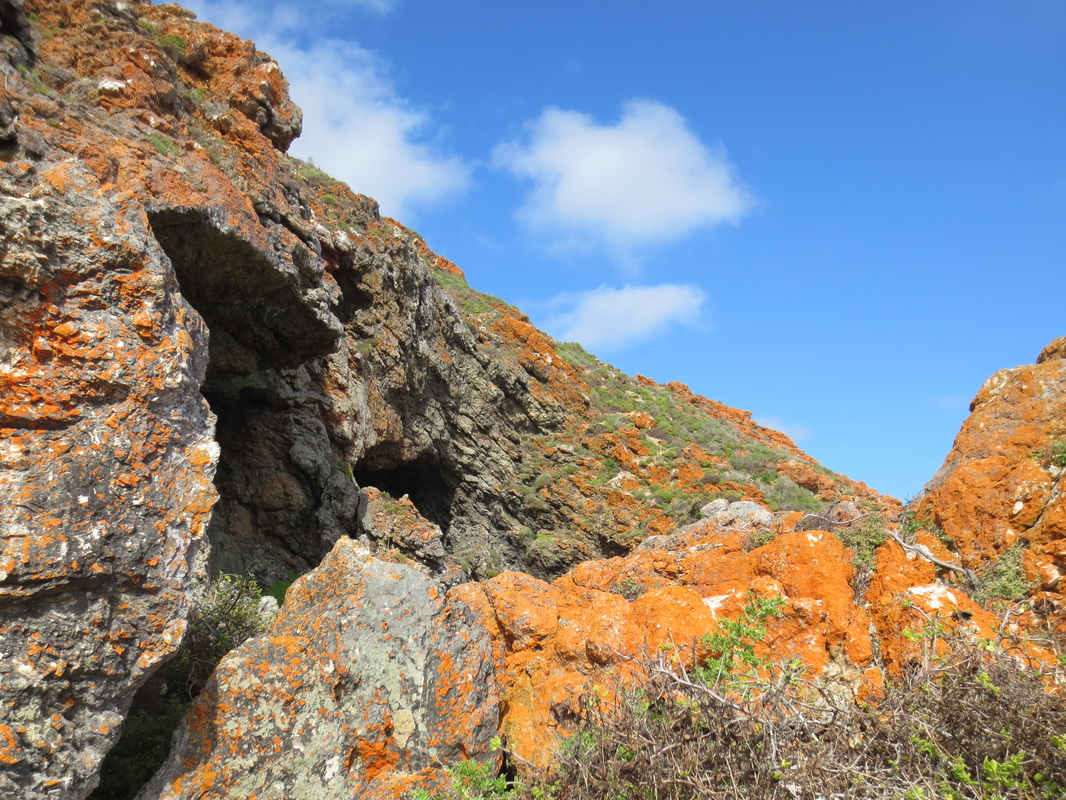
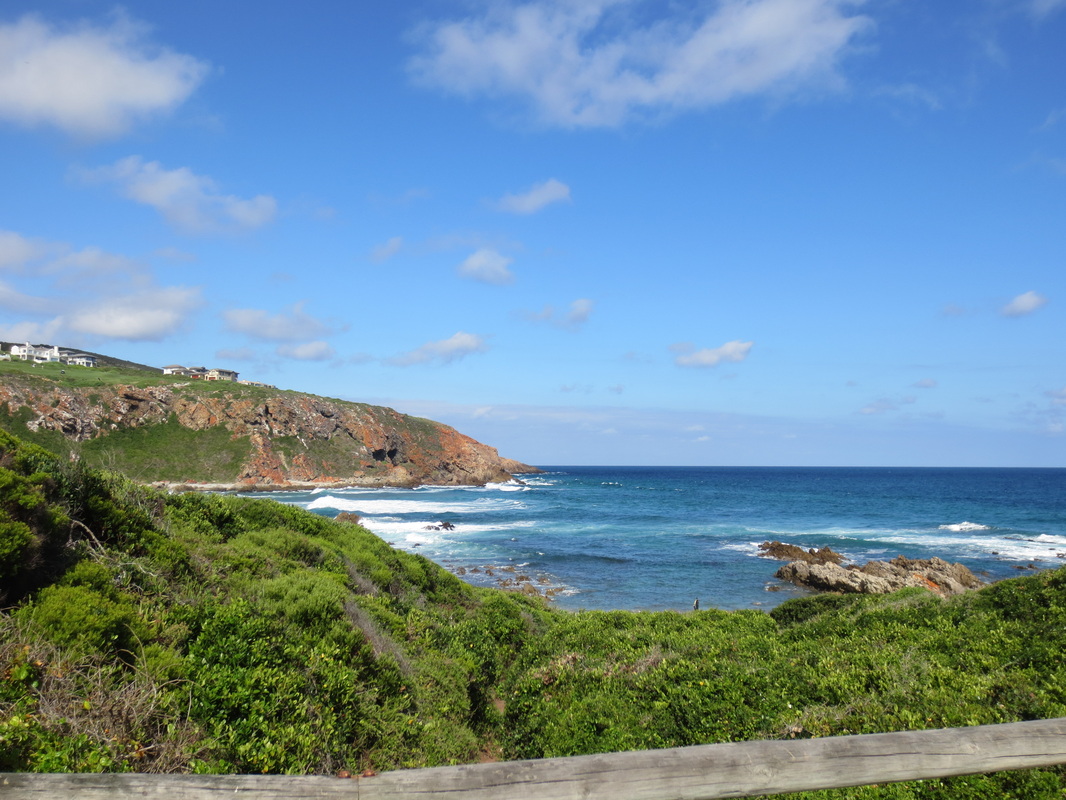
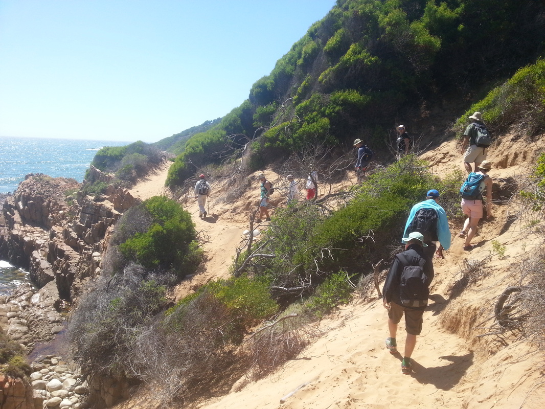
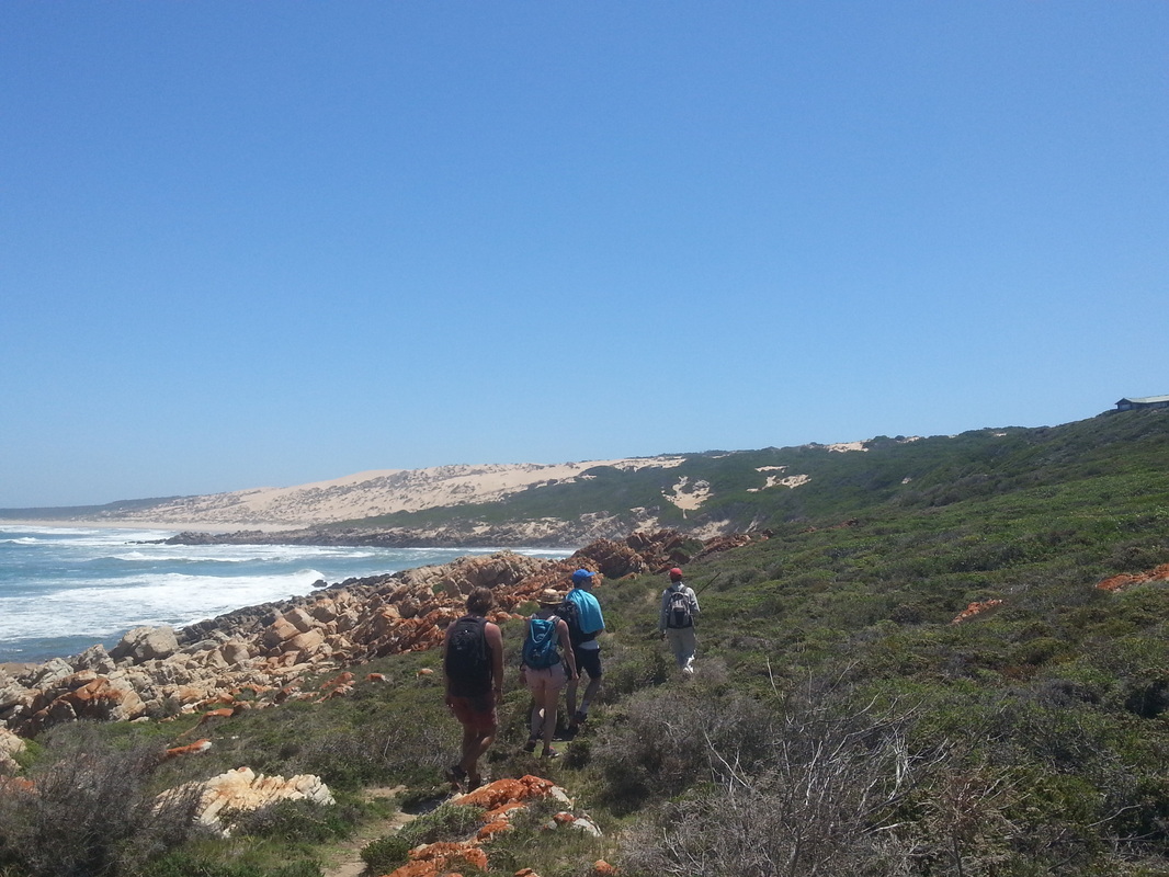
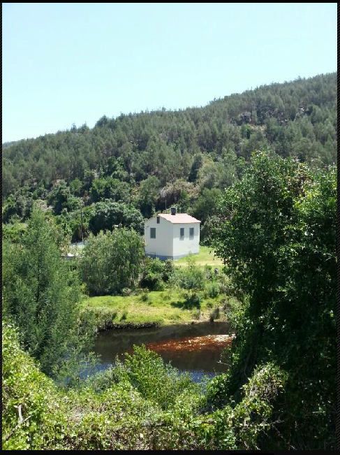
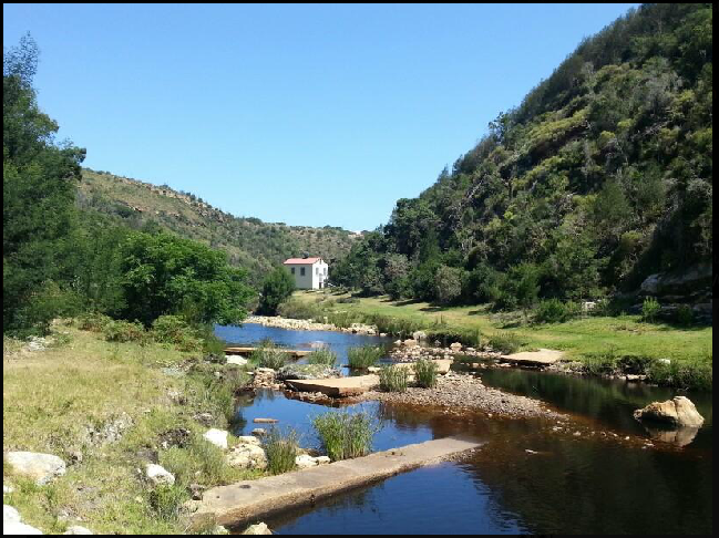
I took a quick walk/hike up to the old Great Brak power station the other day - it's an easy walk - just over 10 minutes to get there - maybe 15 if you go at a more leisurely pace.  It's a great spot for a picnic if you're looking for a short but scenic outing (and remember, you're enjoying it because it's pristine and beautiful - so please, please, please leave it that way for whomever comes next by packing out your rubbish - there aren't any trash bins there).  

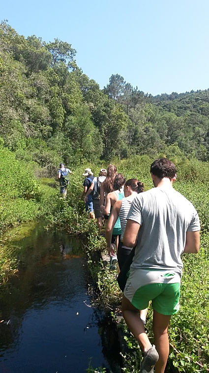
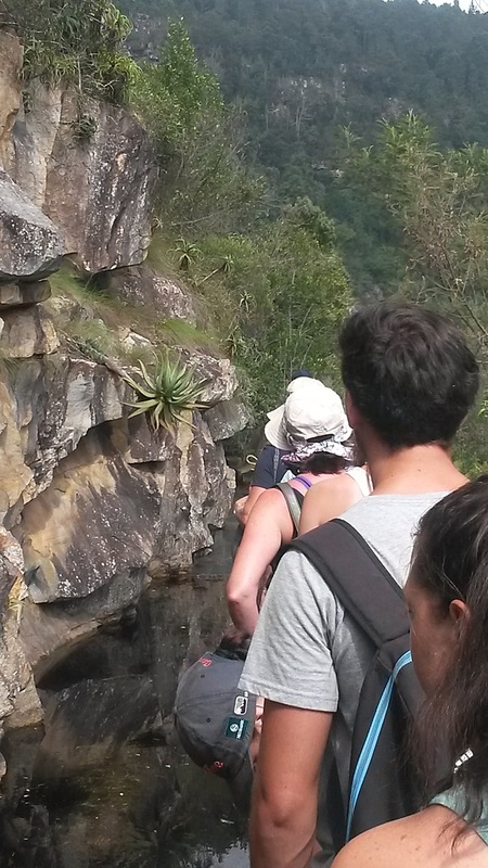
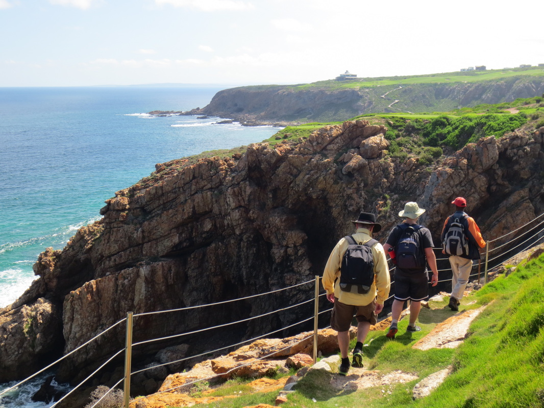
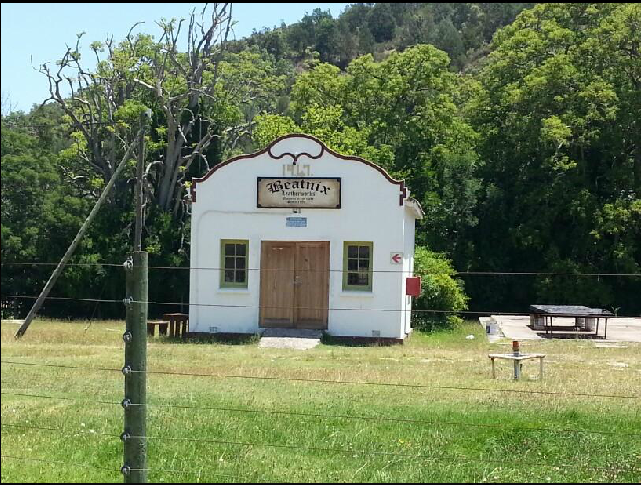
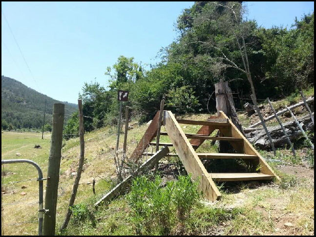
The trail head starts at the end of Willow Road, near Beatnix Leatherworks - just climb up and over the steps, then stick to your left (don't follow the hiking sign that points to your right - that is also a lovely hike, but it takes you along the other side of the river, so you'll miss the power station).

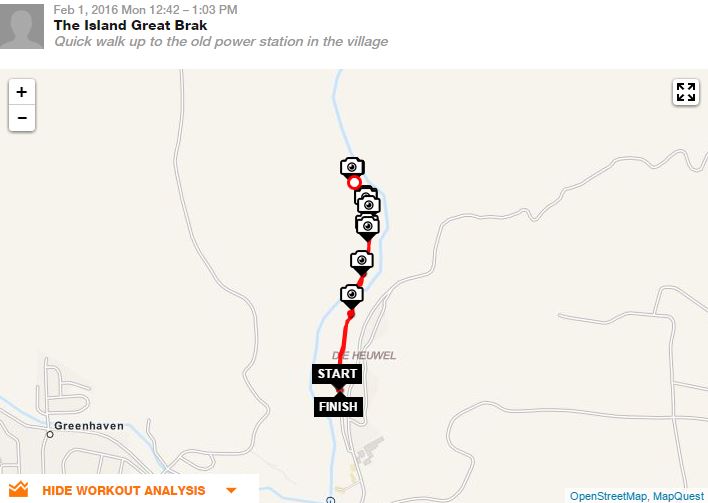
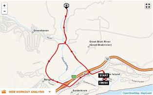
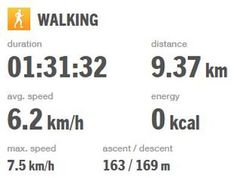
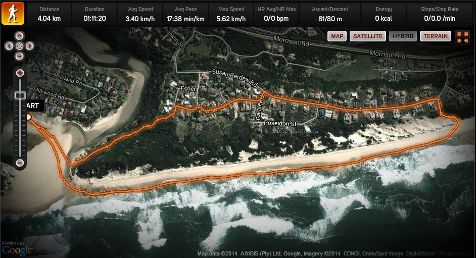
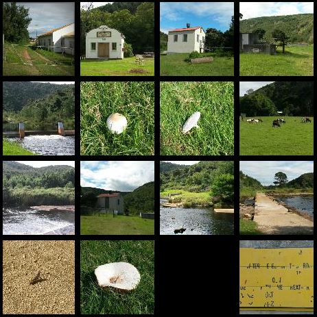
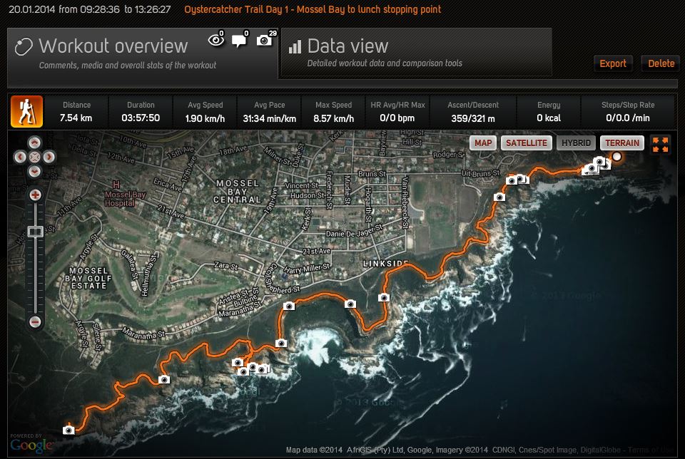
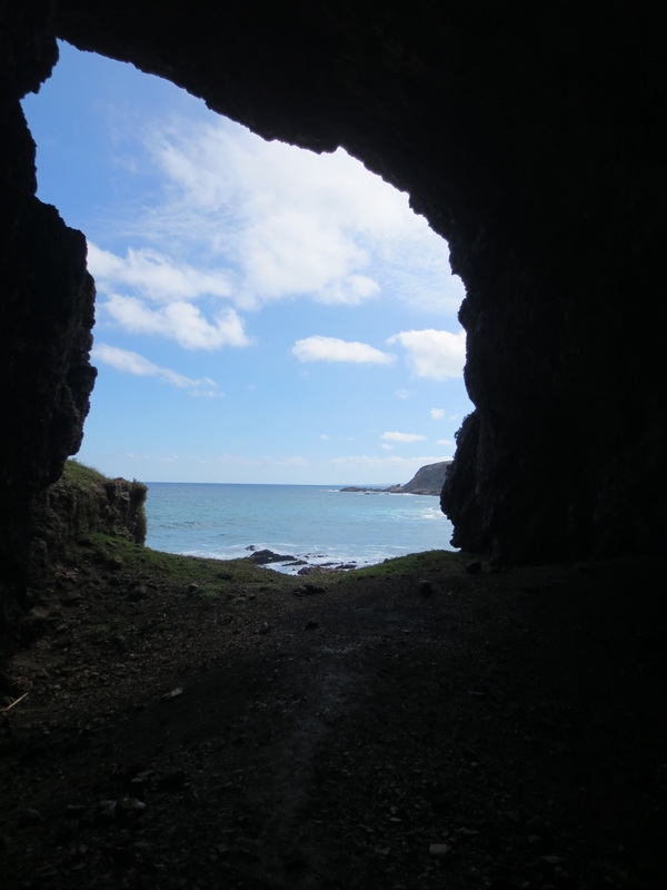
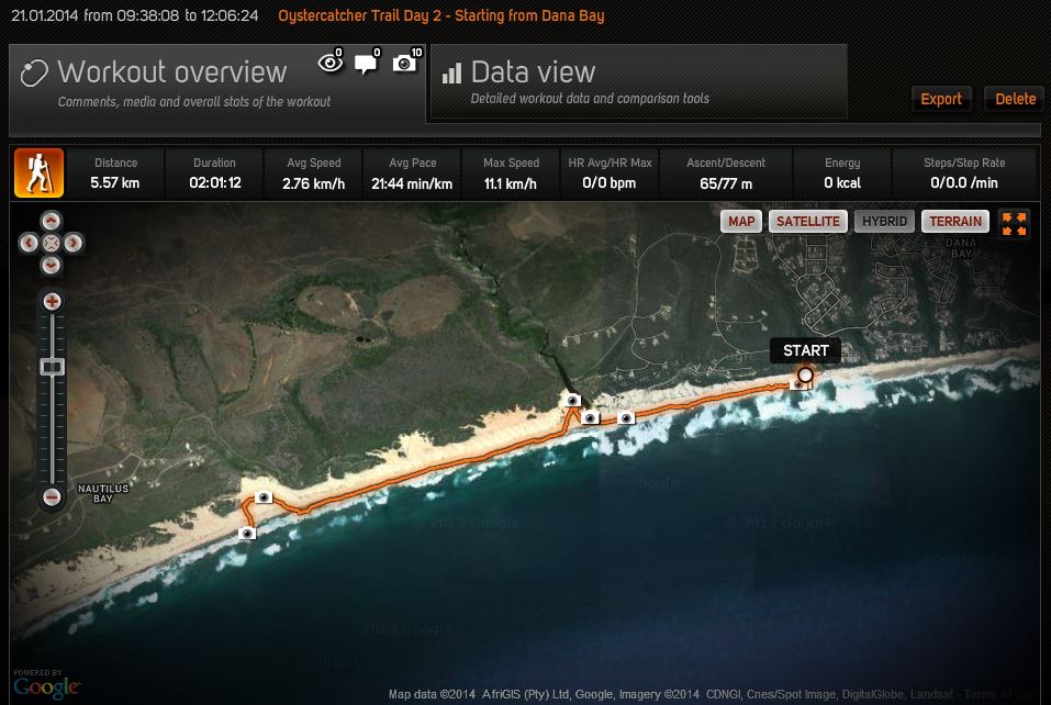
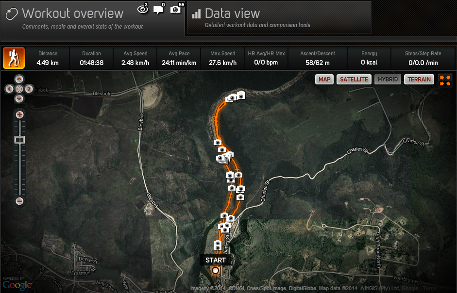
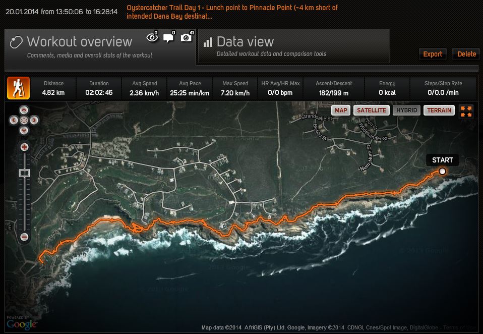
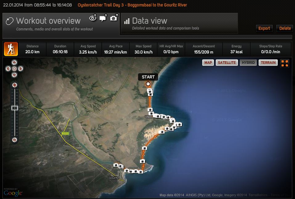
Click on the image below if you'd like to see the full "workout" on www.sports-tracker.com - there are a few photos uploaded as well.
Picture
0 Comments

Hike Up to the Old Willie Searle Furrow Intake & A Dip in the Pools

31/12/2015

1 Comment

 
Had a great group hike up to the intake for the old Willie Searle furrow on a hot day today.  Despite a bit of bushwacking, we were rewarded by spectacular scenery and a dip in the pools (especially the larger natural pool with the waterfall).  Unfortunately, the battery on my mobile phone ran out, so no photos after we reached the intake (the swimming came after that about 500 meters back on the way down).

Thanks to Jeremy for organizing - and of course, to farmer Candace de Jong for granting us access.
Picture
Picture
Picture
Picture
1 Comment

A Quick Walk Up To The Great Brak Pump House

5/2/2015

0 Comments

 
I was up at the Great Brak Pump House on Jan 14th and this is what I saw:
Picture
What's that behind the big "Danger - Do Not Enter" sign? A few calves.
Picture
Yes, cattle.
Picture
No wonder, the fence was completely gone at the back...
I reported it to the Municipality's Technical Department but hadn't heard if it was fixed or not, so I decided today was as good as any to take a walk up to find out - I figured I'd walk from The Island for a bit of extra exercise.
Picture
Picture
And guess what?  It's the fence has been fully repaired - thanks Mossel Bay Municipality!
Picture
The repaired fence - good as new. No more cattle roaming in the sub-station (or electrocuted monkeys for that matter, I kid you not...)
0 Comments

Take a Walk on the Wild Side - Free Entry to the Garden Route National Park During SA National Parks Week (Sept 8 - 12, 2014)

18/8/2014

0 Comments

 
I received this update from SAN Parks' Regional Communications Manager Nandi Mgwadlamba last week - what a great opportunity to take advantage of this fantastic public resource.  Picnic anyone?
Free entry into the GRNP

Over 1,500 people last year responded to the call to visit the Garden Route National Park (GRNP) for free. This year, SANParks invites all members of the public to visit various sections of the picturesque Garden Route National Park(GRNP) during SA National Parks Week (08th – 12th September 2014). The 9-year old campaign held every September encourages all members of the public, young and old to visit National Parks.

Activities of interest planned for this campaign week starting from the 08th – 12th September 2014 include an art and pictures exhibition in the Storms River Rest Camp. On Wednesday, the 10th September, the business fraternity and all small, micro and medium businesses (SMMEs) are encouraged to attend a business workshop organized by the SANParks.  This event starts at 10:00am until 13:00pm.
Picture
Members of the public are invited to ‘bring their picnic basket to the Park’. This day will be celebrated through music and dance by local artists and bands including the battle of popular local DJs. This event scheduled for Friday, the 12th September 2014 will start at 17:30- until late, Storms River Rest camp, Tsitsikamma (see attached map with GPS coordinates). Braai stands are available and rangers will be on stand- by to assist when necessary. 
Picture
In the Knysna section, the public is invited to take a 30-minute stroll in the Garden of Eden guided by rangers between (09:00am and 14:00pm daily during the campaign week). Those interested in seahorses, can visit the SANParks Office on Thesen Island from Monday to Friday (from 10:00am until 12:00am).  Visitors can access the Forest Legends museum in Diepwalle, Knysna forest, for free from Monday- Wednesday between (11:00am – 14:00pm). 
Picture
The focus in Wilderness is on the young at heart as they explore the Park’s various activities such as canoeing through indigenous forests on the Touw River. 
Picture
Free entry into the Park excludes costs for accommodation and activities. To visit various sections of the Park: http://www.sanparks.org/parks/garden_route/

Directions: http://www.sanparks.org/parks/garden_route/tourism/get_there.php

Follow us on facebook and twitter or contact Nandi Mgwadlamba, 044 302 5633 or [email protected], 078 702 9663
0 Comments

Low Tide Beach Walk to Hersham and Back Along the 132-Year Old Vishoek Trail

30/3/2014

0 Comments

 
Another beautiful morning - this time we came back via Hersham and down the Vishoek Trail which was built by local conservancy members around 1882.  Check out the Hiking & Walking or Beach Walking sections of the website for more details about the trail (we took the short-cut, joining it from the side-trail at the corner of Esher Crescent, instead of further down where Susan Pardew Road meets Hersham Drive) or other options in the area.

See the route we took on the Sports-Tracker.com website by clicking on the image below.
Picture
0 Comments

A Nice Afternoon for a Short Walk up to the Great Brak River Pump Station

9/3/2014

0 Comments

 
A nice afternoon with a little bit of cloud cover (not too hot!) - perfect for a short stroll to the Great Brak River Pump Station (downstream from the Wolwedans Dam).  It's less then 2 km there and back from the parking lot opposite Beatnix Leatherworks.  Though it was a bit wet after last night's rainfall.

To get there, take Charles Street (the road the Spar - soon-to-be PicknPay) is on and turn left on the gravel road (Willow Street) just after the bottle store (opposite the New Apolostic Church).  You'll pass about 5 houses lining the Great Brak River before coming to the end of the road which marks a good spot to park.

Walk a bit further up the road and you'll come to a few steps which you climb before reaching the trail head.  To do the "official" trail, take the route to your right (marked by a foot sign).  For a description of that great little hike see this previous blog post.  Otherwise, go as we did this time and continue walking straight through the cow pasture, across the weir and onward until you see the pump station.  A great place for a picnic!

Click on the image below for the full "work-out" details as well as several photos
Picture

Picture
0 Comments

Slackpacking the Oystercatcher Trail

25/1/2014

0 Comments

 
Picture
After attending a talk and archaeological tour of the Pinnacle Point caves last week, we were lucky enough to squeeze into a couple of open slots on Fred Orban's renowned Oystercatcher Trail which starts just down the road at Mossel Bay.  We joined 9 others (a group of 5 and two other couples) who were doing the slack pack trail, and with apologies to my Xhosa friends, we just "clicked" - it really was a great group and a great hike.

We were led by the famous Xhosa guide Willie Komani who was assisted by South Cape Rangers' Chris Carr.  We were a bit slow on the first day, so unfortunately, we didn't quite reach the planned end-point at Dana Bay.  Instead, we stopped about 4 km short at Pinnacle Point (some of us scrambled down to one of the caves below with Willie - don't worry, it wasn't one of the caves currently under archaeological examination).
Picture
Our guides Willie Komani (with the red cap & walking stick) and Chris Carr (3rd from the right with the binoculars & baseball cap)
We saw all kinds of wildlife - oystercatchers (of course - including a couple of chicks and eggs), terns, gulls, fiscal shrikes, sunbirds, swallows (forecasting good weather as they sat in a row on the telephone line), cormorants, as well as dassies, tortoises, a couple of snakes, bats, lizards, skinks, agamas and numerous plants which Willie had a million-and-one uses for....

Throughout the trip, Willie told us about the traditional medicinal uses for the various plants we came across - or he explained the feeding habits of the varied bird life - that is when he wasn't walking straight up to nearly invisible oystercatcher nests (they lay their eggs in a little hollow in the sand), or pointing out pairs of wrestling snakes from 50 metres away.  Chris, meanwhile, spoke about the efforts underway to stop people from feeding the dassies in Mossel Bay, and enthusiastically shared his knowledge of the flora & fauna in his own affable and good-natured way.  Both of our guides were knowledgeable about the archaeological work in the area - and showed us numerous middens where seashells had been discarded by previous inhabitants, and where there was evidence of ancient stone tool use.  Between the two of them, we were certainly in good hands.
Picture
Picture
As usual, I tracked our route with Sports-Tracker and snapped some photos along the way.  My battery was draining pretty quickly so, with the exception of the last day, I split the tracking into two parts each day to ensure I didn't lose it all if the battery ended up dying.  Click on any of the tracking images below to see the route details on Sports-Tracker, including photos - or go to the respective Flickr Sets for the photos themselves.

Day One - 12.36 km

Picture
Day 1 - Part 1 - from the Point Hotel, past the Cape St. Blaize lighthouse and along the coast, down a steep section to see a cave before reaching our lunch spot (7.54 km).
Click here or any of the photos below to view the complete Flickr Set of the photos from this section of the hike.
Picture
Picture

Picture

Picture
Picture

Picture
Lunch!
Picture
Day 1 - Part 2 - from our lunch spot to Pinnacle Point - with a meander through our first cave - that's the squiggly bit just in from the left. 4.82 km this section and 12.36 km for the day (about 4 km short of Dana Bay, our intended destination).
Click here or any of the photos below to view the Flickr Set of the photos from this section of the hike.
Picture
Picture

Picture

Picture
Picture
After a cool drink in the clubhouse, we were transported to Boggomsbaai where each couple (or family) was shown to their own charming & cosy Sandpiper Cottage, followed by a communal dinner & drinks at the Sandpiper Sports Centre.
Picture
Picture

Picture
Picture

Picture
Picture

Picture
Picture

Day Two - 16.37 km

The next morning, we were back at it.  First breakfast at 8:00, then at 9:00 we were whisked back to Dana Bay for the start of that day's hike which would see us walk along the entire crescent beach, returning to the Sandpiper in our bare feet.  There was time for some great body surfing along the way and a dip in one of Willie's secret swimming holes.  The water was a bit tea-coloured due to the recent run-off, but that didn't stop us - it was a welcome cool down from the unrelenting heat of the sun!  And then, we spotted the dolphins...
Picture
Day 2 - Part 1- from Dana Bay to the edge of Nautilus Bay (5.57 km)
Click here or on any of the photos below to view the Flickr Set of the photos from this section of the hike.
Picture
Our secret swimming hole!

Picture

Picture

Picture
The many middens along the route provoked a lot of discussion...
Picture
Look, dolphins!

Picture

Picture
Picture
Day 2 - Part 2 - from Nautilus Bay to Boggomsbaai (10.8 km) and 16.37 km for the day.
Click here or on any of the photos below to view the Flickr Set of the photos from this section of the hike.
Picture
Picture
Once back, we showered before heading to Sandpiper Sports Centre for drinks and a bit of an archaeological appetizer as Fred Orban gave a run through of Curtis Marean's work at Pinnacle Point Caves, as well as a peak at Peter Nilssen's presentation before dinner.

Day Three - 20 km

The next morning, we hiked from the Sandpiper Sports Centre, down to the beach and all along the coast, passing by Vleesbaai before stopping for lunch at Fransmanshoek - and you guessed it, more great body surfing (some were a bit thrown off by the sports angler attempting to reel in a shark on the nearby rocks, but I figured so long as the line remained taut, it meant there was one less shark to worry about!).
Picture
Day 3 - the big finale - from Boggomsbaai to the Gouritz River. 20 km on the dot.
Click here or on any of the photos below to view the Flickr Set of the photos from this section of the hike.
Picture
Picture

Picture

Picture

Picture
Picture

Picture

Picture

After lunch, we continued along the coast until we reached the Gouritz River where a boat ferried us to the other side where our transport back to Sandpiper was waiting.
Picture
Picture

Picture
The home stretch...
Picture

Picture
Day 3 was a long, hot day - even though some found it a bit gruelling, I think it was still everyone's favourite - it had a bit of everything: rocks to scramble atop of, beach walking, cartpaths in Karoo-style farmland near the Gouritz - you name it.  It really was majestic.
It was a great trip from beginning to end - and Fred kicked off the celebration by offering up couple big platters of oysters (from Munro's in Little Brak, of course!) and champagne during "prize giving", followed by dinner on our last night back at the Sandpiper Sports Centre.
Picture
Picture
Thanks Fred, Willie, Chris, Annemarie and the rest of the Sandpiper/Oystercatcher team - as well as the other hikers (Blair, Jane, Gareth, Thomas, Liam, Rainer, Cherry, Mark & Katherine) - for making it such a fun and memorable trip!
0 Comments

A Leisurely New Year's Hike to the Great Brak Pump Station

2/1/2014

0 Comments

 
It was the perfect day for a leisurely hike past the pump station at Great Brak - you can carry on well past it if you stay on the right-hand side of the river (some great swimming holes with the release of water from the Wolwedans dam earlier in the a.m.).  There is some minor bushwacking required as the trail is not maintained.  It's not advisable to go much beyond that, as from there the original trail has been completely eroded during earlier floods.  The trail is marked with either green spray paint (on rocks or tree stumps) as well as with the occasional double bare footprint in white paint - though you if you simply follow the small rock wall on the right-hand side of the river bed you'll find it easy to keep on track.  You can return from the other side of the river if you watch carefully for a path through the brush (see the photos).  Or you can simply walk along the dusty road all the way to the pump station & back.

There is plenty of bird life - and if you're stealthy, you'll come across buck and monkeys, too - and many great sites for a picnic lunch or dip in the refreshing water (don't be put off by the tea colour!).

Oh - and you'll note a strange orange/yellow sign missing virtually all of its letters - in fact, it is a warning to be cautious of water being released unannounced from the Wolwedans dam upstream!

Click any of the images below for more info on the route or for photos (there are many more on the sport-tracker site).
Picture

Picture
Picture
Picture
Picture
Picture
0 Comments

    Author

    TheIsland@GreatBrak features the occasional blogpost in between braaiing and beach walks - stay tuned or drop me a line.

    Picture

    Archives

    December 2018
    December 2017
    April 2017
    February 2017
    December 2016
    November 2016
    February 2016
    January 2016
    December 2015
    October 2015
    August 2015
    July 2015
    June 2015
    May 2015
    April 2015
    March 2015
    February 2015
    January 2015
    December 2014
    November 2014
    August 2014
    May 2014
    April 2014
    March 2014
    February 2014
    January 2014
    December 2013
    November 2013
    October 2013
    September 2013
    August 2013
    July 2013
    June 2013
    April 2013
    March 2013
    February 2013
    January 2013
    December 2012

    Categories

    All
    2013/14 Holiday Season
    2014/15 Holiday Season
    2015/16 Holiday Season
    Adrenaline
    Anything That Floats - 2013
    Anything That Floats 2015
    Anything That Floats 2016
    Art Galleries & Exhibitions
    Auctions
    Beach
    Beach Walks
    Beer
    Birds
    Bootcamp
    Braai
    Bridge
    Coastal Cleanup
    Cycling
    Diaz Express
    Exercise
    Fishing
    Food
    George Agricultural Show
    Getting Here
    Golf
    Great Brak Muse Fest
    Great Brak River Community Network
    Great Brak River Tourism Initiative
    Hiking
    Island Life
    Kayaking
    Kite Surfing
    Klein Karoo
    Load Shedding
    Loadshedding
    Lost & Found
    Markets
    Meerkats
    Mountain Biking
    Mouth
    Music
    Neat Websites Apps
    Night Time Paddling
    Ocearch-shark-tracker
    Oudtshoorn
    Paddling
    Paragliding
    Photos
    Pilates
    Pinnacle Point Caves Points Of Human Origin
    Rheenendal Ramble
    Road Trips
    Roadworks
    Running
    Sedgefield
    Sharks
    Ships
    Stars
    Sunset
    Swimming
    Things To Do
    Tide Pools
    Trans Agulhas Challenge
    Vacation Rentals
    Village Marching Band
    Vistas
    Where To Eat
    Yoga


    Subscribe in a reader

    Get the latest Island blog updates delivered direct to your inbox:

    Enter your email address:

    Delivered by FeedBurner