|
So what do you do on a windy day? Well, you grab your kite & harness and strap on your board if you're anything like the three guys who were out on the lagoon today (better the lagoon than the sea, especially with gusty, erratic wind conditions if you're not into becoming shark bait, IMHO).
0 Comments
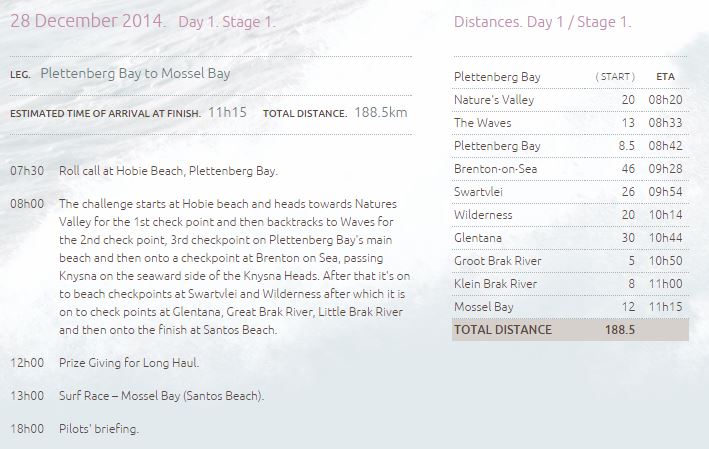
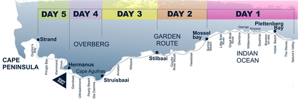
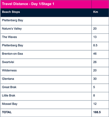
Well, the skies cleared this morning but it became rather blustery. So, what to do when there's 15 knot (~28 km/hr) winds? Grab your kite & board and go kite surfing, of course. At least that's what 9 guys decided to do this afternoon - here are some pics (slideshow, so choose the image to display or scroll through). Just don't lose your kite past the breakers, kids, or you might come face-to-face with the Great White sharks who move to this area from Mossel Bay's Seal Island during the summer. I guess that's why you don't often see kite surfing here, especially off the mouth... :) If you're looking for a bit of excitement on the beach, Day 1, Stage 1 of the 2014 Trans Agulhas Challenge (billed as "The World's Toughest Inflatable Boat Challenge") is due to hit Glentana at about 10:44 a.m. on Dec 28th, before reaching Great Brak River ariound 10:50 a.m.
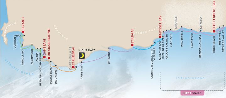
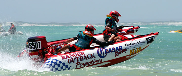
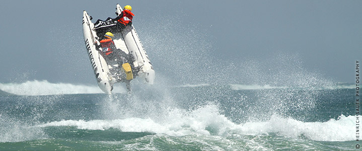
You can read more about the event in this Mossel Bay Advertiser article (though it seems they have the dates wrong) - or check out the blog posts from last year's event. Now, admittedly, not everyone is into running or cycling - but that doesn't mean you have to miss out on the fun if you're into a bit of adrenaline and speed is your thing. Certainly not with the Trans Agulhas Challenge making a pitstop at the Great Brak beach on Dec 28th (stage 1 of the multi-stage event). Check out the slide show below for an idea of what to expect! Racers who take part in what is billed "the world's toughest inflatable boat challenge" leave Hobie Beach at Plettenberg Bay at 8:00 a.m., heading up to Nature's Valley before doubling back down the coast a series of checkpoints along the way. The 7th, 8th and 9th checkpoints are at Glentana, Great Brak and Little Brak, respectively, before the final stop for the day at Mossel Bay's Santos Beach. If that's something that sounds like fun to watch (bring your camera and earplugs...), then head on over to the PSPG Trans Agulhas Challenge website - or better yet, the event's official website - for more info and spectacular photos. More info is also available in the George Herald.
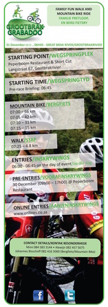
During the holiday season, the area from George to Mossel Bay goes crazy with road runs, trail runs, mountain bike races, and all sorts of combinations of the two. It's incredible. Great Brak is right in the thick of things, with many events taking place here. Of course, there's the Great Brak Grabadoo, held annually each December 31st. This year is no different, so if you're a keen mountain biker (or are into the family fun walk), get your gear on and register now. Click on the image below to register or to find out more - or read the latest article about the event in the Mossel Bay Advertiser.
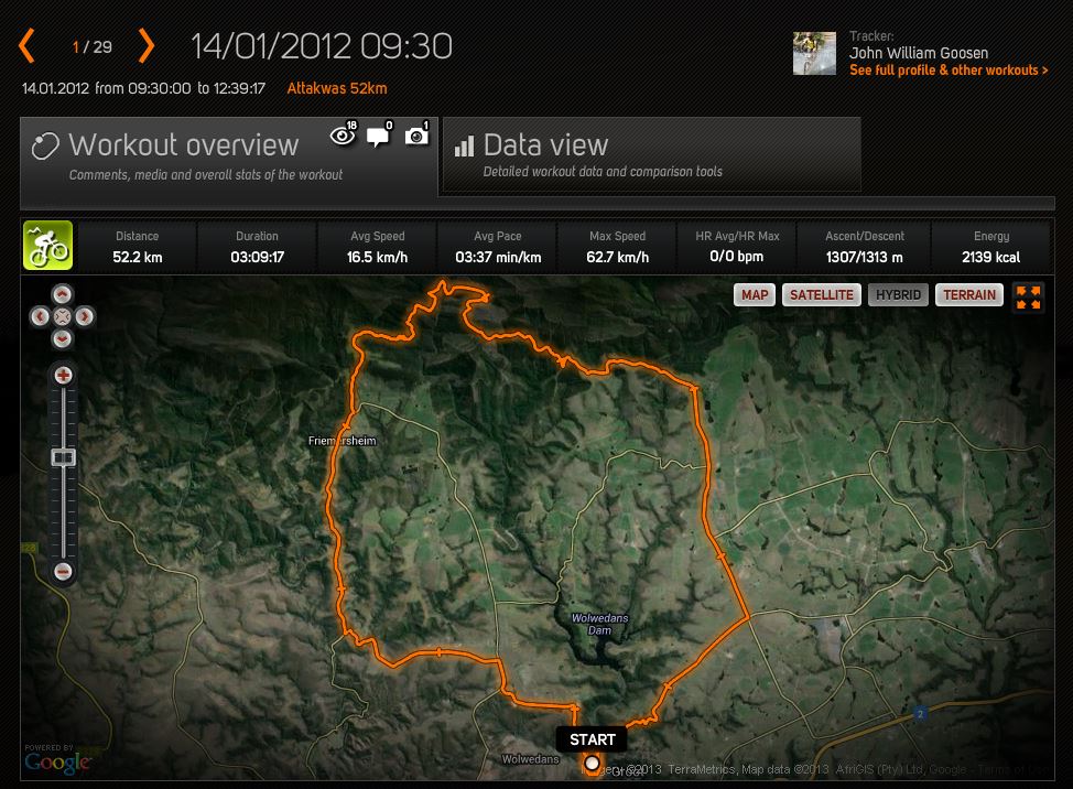
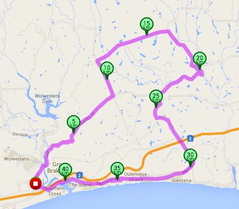
For a more challenging ride, there's the 52.2 km's Attakwas route which loops up behind Friemersheim. Similar to other routes posted in the Cycling section of this website. This particular ride was posted by fellow Sports Tracker user John William Goosen last year. Check it out at: http://www.sports-tracker.com/#/workout/johnwgoosen/3q3et6dohs7snlaf
The last of three great cycling routes shared by local biker "Vera". This one has a moderate rating, and takes the rider into the farmland behind Great Brak River - great views of the Outeniqua Mountains back there, and then those glorious, sweeping ocean vistas on the way back into the village. 42.30 km's from the starting point at the Peperboom Restaurant on Long Street. Check it out at:http://www.bikely.com/maps/bike-path/perdeplaas-great-brak-river
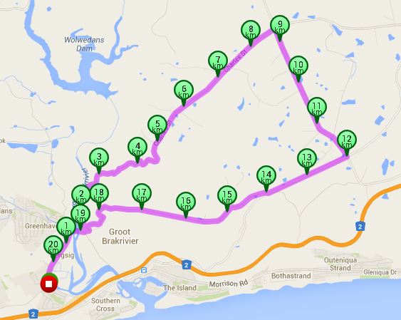
Another great cycling route shared by local biker "Vera". This one is fairly easy/moderate, especially with the great descent down by the Spar on the way back to the village. 20.55 km's from the starting point at the Pepperboom Restaurant on Long Street. Check it out at: http://www.bikely.com/maps/bike-path/spar-route-great-brak-river
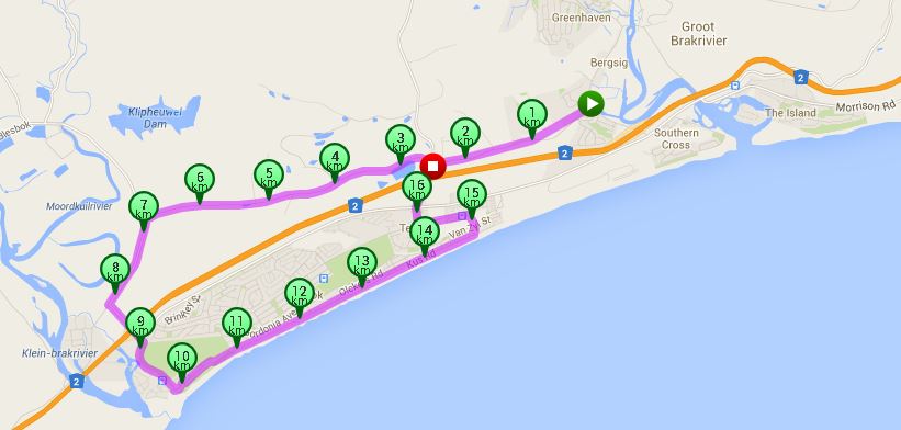
One of three great coastal cycle routes tracked by local biker "Vera" on the www.bikely.com website. This one is 16.72 km's long, starting from the Peperboom Restaurant on Long Street. It goes out the gravel road near the old brick yard, by the ostrich farms and back along the old R102 from Little Brak. Mind the traffic as you share the road. Check it out: http://www.bikely.com/maps/bike-path/vera-1
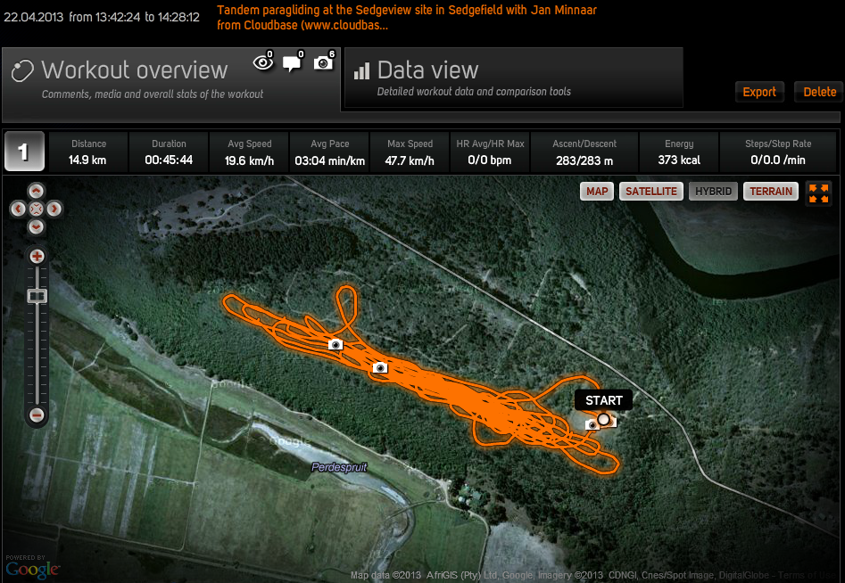
Had a great tandem paragliding ride with Jan Minnaar of Cloudbase at the Sedgeview launching/landing site above Sedgefield today - something I have been meaning to do for a long time - great fun and perfect timing before the colder winter air sets in! I tracked our flight with my GPS and saved it as a "work out" (hardly!) on Sports-Tracker together with some photos. Here's one of the videos Jan took of us "chillaxing" while we rode a mild thermal to about 300 meters: More photos available on our Flickr photostream.
Look for me overhead the N2 later in the year as I may get the urge to do the full course. Meanwhile, if you're looking to satisfy a long-harboured thrill, check out the "For the Adrenaline Junky" section of this website for more ideas! |
AuthorTheIsland@GreatBrak features the occasional blogpost in between braaiing and beach walks - stay tuned or drop me a line. Categories
All
Get the latest Island blog updates delivered direct to your inbox:
|
