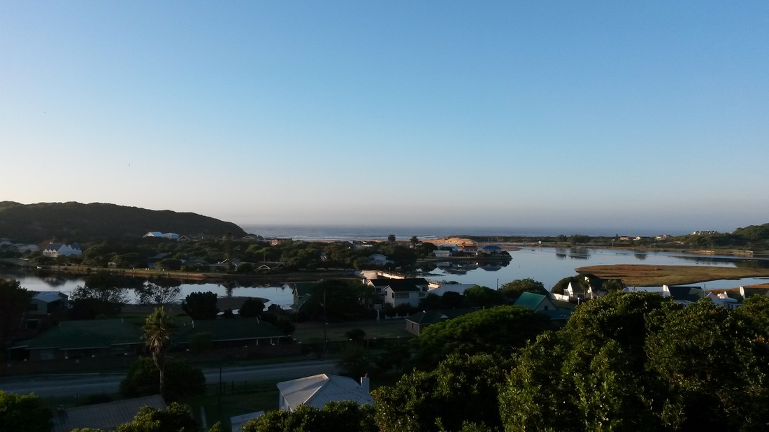
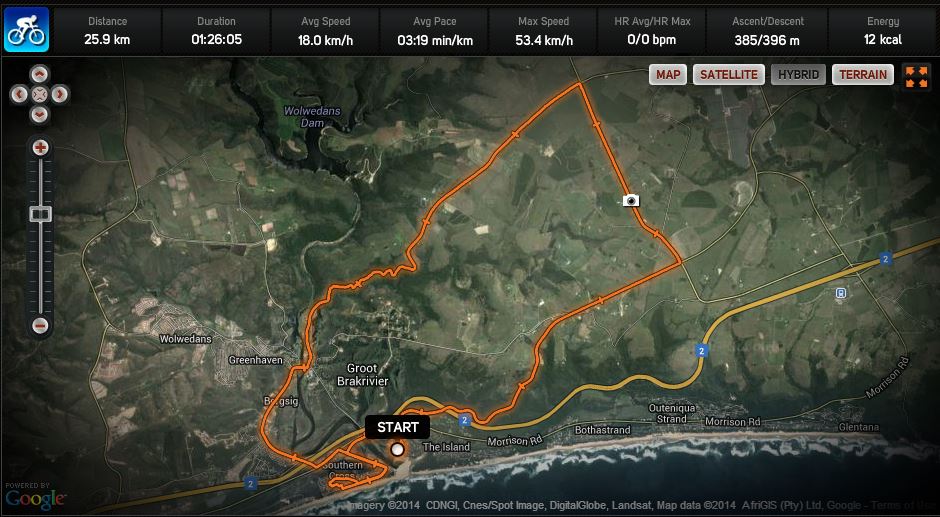
A bit of a sprint up the R102, getting to the top just before the fog rolled in, then back out to the farmland at the foot of the Outeniqua mountains and down the winding Charles Street gravel road overlooking the old pump station and along the Great Brak River back to The Island. The sun has now burned off almost all of the fog, with just a few puffs of mist remaining - no doubt, the beginning of another spectacular day!
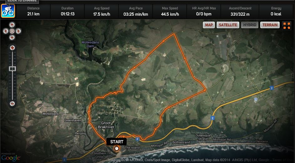
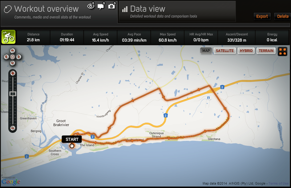
Click on the image below for the full workout details on Sports-Tracker.com
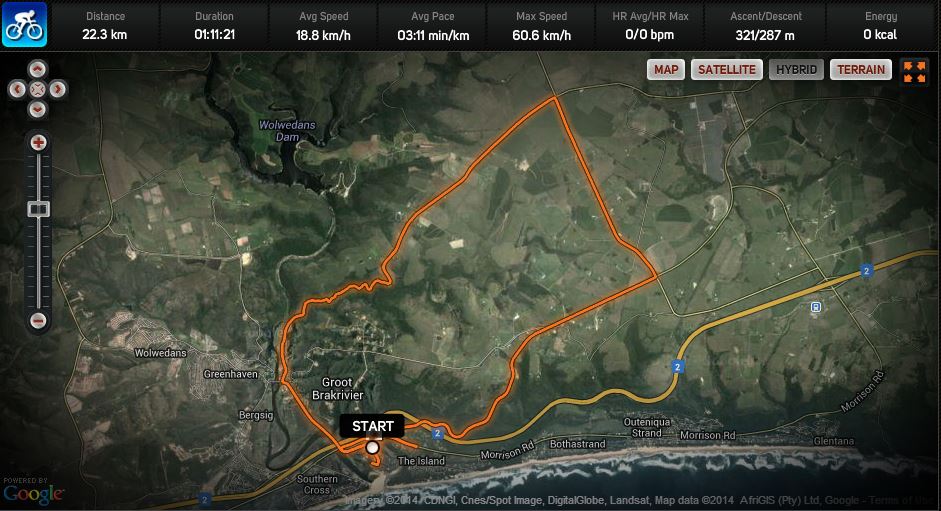
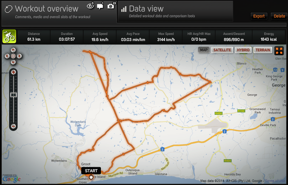
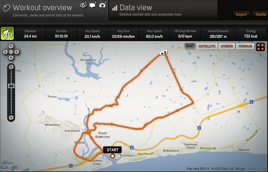
Click on the image below for the full workout details on Sports-Tracker.com

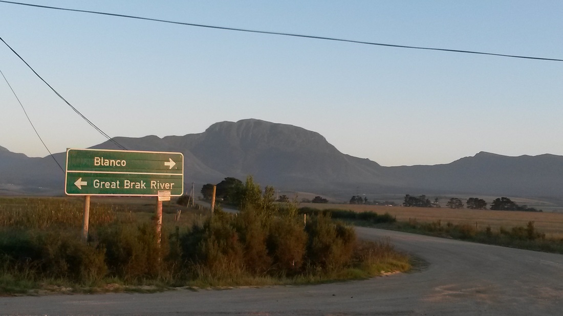
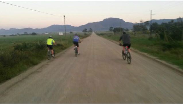
The Outeniqua Mountains had that incredible violet hue to them... this is the turn to head down Charles Street
| 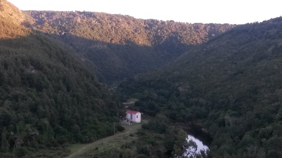
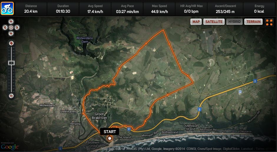
The old pump station on the Great Brak River down stream from the Wolwedans dam
|